
Free GPR Datasets for Roads and Pavement Inspection
Real-world radargrams for layer thickness measurement, delamination detection and structural pavement assessment
Road agencies and pavement engineers use Ground Penetrating Radar as a fast, non-destructive method to assess pavement structure: layer thickness, delamination, subsurface moisture, and structural integrity. Compared to core sampling, GPR provides continuous data over long survey lines, enabling network-scale condition assessment in a fraction of the time and at a fraction of the cost.
GPRbase provides free road and pavement GPR datasets acquired on real infrastructure: highways, urban streets, airport runways, and heavy-duty pavements. Each dataset contains raw radargrams in GSSI format (.DZT), with details on the surveyed structure when available. Data is distributed under Creative Commons BY-NC-SA 4.0, allowing free use for training, research, algorithm development, and pavement management system development.
These datasets support pavement engineer training, algorithm research on automated layer picking, machine learning for defect classification, and pavement management system development. The datasets capture the acquisition realities of high-speed road surveys: coupling variability, surface roughness, and structural transitions that appear only in real-world data.
Road and pavement GPR datasets
Free raw radargrams — download and explore — 1 datasets available
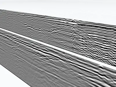
GPR for pavement inspection
GPR is fast, continuous, and non-destructive — ideal for network-scale pavement assessment. It complements Falling Weight Deflectometer (FWD) testing, core sampling, and visual inspection by providing subsurface information over kilometers of road in a single survey day. This makes it essential for pavement management systems, condition monitoring, and rehabilitation planning at the network level.
Pavement layer thickness measurement
GPR precisely identifies asphalt, base, and subbase layer interfaces through their dielectric contrast. Layer thickness is calculated from signal travel time with proper velocity calibration, achieving 5-10% accuracy in typical conditions. This information is critical for quality control on new construction, remaining service life prediction, and rehabilitation design.
Delamination and defect detection
Debonding between asphalt layers creates characteristic multiple reflections at the delaminated interface. Trapped moisture, cracking, and rutting also produce distinctive GPR signatures. Early identification of these defects enables preventive maintenance rather than costly full-depth rehabilitation, significantly extending pavement service life.
Structural condition assessment
Combined thickness and defect mapping supports overlay design, rehabilitation planning, and remaining life estimation for road network segments. GPR data feeds into pavement management systems, enabling evidence-based investment decisions across the network and prioritization of maintenance actions.
GPR frequencies for road surveys
For detailed pavement structure investigation, 1-2 GHz air-launched horn antennas or ground-coupled antennas are standard, providing high resolution of the top 30-60 cm. For deeper investigations reaching the subgrade and structural layers below, 400-900 MHz antennas offer better penetration. Vehicle-mounted air-launched systems can survey at highway speeds (up to 100 km/h).
What these datasets let you practise
Pavement surveying rests on interface picking rather than point-target detection. The available dataset gathers six dual-frequency profiles recorded along a motorway emergency lane, in ground conditions highly favourable to wave propagation. Interfaces and structural layers are numerous and legible, which makes it well suited to learning thickness picking and to converting travel time into thickness under a stated permittivity assumption.
The same acquisition also serves geotechnics: the boundary between pavement structure and subgrade is precisely the interface to identify.
Which software opens these files · Select these datasets programmatically
Download raw road GPR data
All datasets are raw radargrams in .DZT format, without pre-processing or automatic layer picking overlay. This makes them ideal for realistic training on network-scale interpretation, algorithm development for automated pavement analysis, and educational use in pavement engineering courses. Free download, immediate access, no account required.
In preparation
The following datasets are being prepared for this application.
- Asphalt overlay thickness on a bridge deck autumn 2026
Do you hold an acquisition of this kind? We would be glad to publish it, with credit to the contributor.
Frequently asked questions — Road GPR
Can GPR measure asphalt density?
Not directly. GPR measures signal travel time and reflection amplitude, from which dielectric properties can be estimated. Air voids (a density proxy) can be inferred from dielectric measurements, but direct density measurement requires nuclear or non-nuclear density gauges.
At what speed can I conduct GPR surveys?
Vehicle-mounted air-launched horn antennas can survey at up to 80-100 km/h with GPS positioning — enabling network-scale surveys without traffic disruption. Ground-coupled antennas typically require walking or slow driving (10-30 km/h).
Do these datasets include GPS-referenced data?
Some datasets include .DZG files with GPS traces alongside the .DZT radargrams. The dataset metadata specifies whether GPS data is available.
Can I use these for AI-based pavement condition assessment?
Yes, under CC BY-NC-SA 4.0. Real defect signatures with authentic road surface variability and network-scale acquisition patterns are excellent training data for machine learning models.
Are the datasets from highways or urban roads?
Both, when specified in the metadata. Highway datasets typically feature high-speed acquisition patterns; urban datasets include additional complexity from buried utilities, patches, and multi-layer histories.
Have road survey data to share?
Contributions from pavement engineers, road agencies, and researchers enrich the community. Every dataset submitted improves training and research in pavement management.
Submit your data