
Free GPR Datasets for Underground Utility Detection
Real-world radargrams for locating buried pipes, cables and ducts before excavation
Locating buried utilities before excavation is one of the most safety-critical applications of Ground Penetrating Radar. Every year, thousands of utility strikes cause service interruptions, injuries, and costly repairs. GPR provides a non-destructive way to detect, map, and characterize underground pipes, cables, and ducts before any ground disruption.
GPRbase provides free datasets acquired on real utility surveys: urban streets, industrial sites, road crossings, and greenfield investigations. Each dataset contains raw radargrams in GSSI format (.DZT), documented with acquisition context and target information. Data is distributed under CC BY-NC-SA 4.0 for free use in training, research, software development, and public awareness programs.
These datasets support utility detection training, SUE (Subsurface Utility Engineering) skill development, machine learning research on utility classification, and the validation of automated detection algorithms. Real subsurface conditions are represented: multi-utility corridors, deep drainage, mixed materials (metal, PVC, concrete), and challenging soil types.
Underground utility GPR datasets
Free raw radargrams — download and explore — 10 datasets available
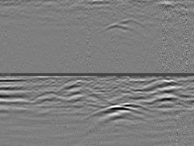
Buried Utilities Beneath a Reinforced Concrete Slab: Detection Through Dense Reinforcement
A 4.50 m profile recorded with a GSSI UtilityScan DF dual-frequency 300/800 MHz antenna, on a reinforced concrete slab, perpendicular to the…
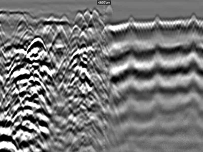
Industrial Slab GPR Survey: Heterogeneous Reinforcement and Subgrade, Inputs for Bearing Capacity Assessment
Profile recorded on a factory floor with a GSSI UtilityScan DF dual-frequency 300/800 MHz antenna, ahead of new works. No records exist, no …
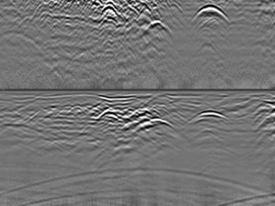
Multiple Utilities and Airwave — Distinguishing Surface Reflections from Buried Targets
Utility survey acquired with a GSSI UtilityScan DF dual-frequency antenna, showing several buried utilities together with a clear airwave si…
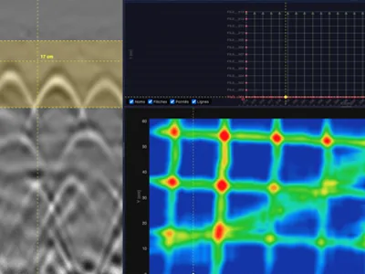
3D Grid on Reinforced Concrete — Rebar Mesh and Diagonal Electrical Cable
3D grid acquired on a reinforced concrete slab with a GSSI StructureScan XT 2.7 GHz antenna: 38 profiles over a 1.2 × 0.6 m area. The horizo…
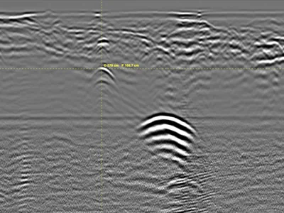
Unrecorded Utility Crossing Under a Street — Parallel GPR Profiles at 350 MHz
Utility survey on a street, acquired with a GSSI UtilityScan 350 MHz HyperStacking antenna: 9 parallel profiles spaced 1 m apart, crossing t…
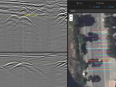
Georeferenced Multi-Utility Mapping - 30 RTK GPR Profiles at 300/800 MHz
Multi-utility GPR survey acquired for cartographic updating ahead of planned works, with a GSSI UtilityScan DF dual-frequency antenna. 30 pr…
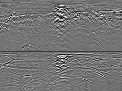
Utilities & Interfaces in Favorable Soil with Deep GPR Penetration
GPR dataset containing 1 file collected with a GSSI UtilityScan DF dual-frequency 300/800 MHz ground penetrating radar in highly favorable s…
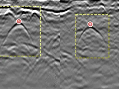
Ground-penetrating radar detection of gas connections (HDPE polyethylene)
4 dual-frequency ground-penetrating radar profiles (UtilityScan DF) showing the location of HDPE (High-Density Polyethylene) gas connections…
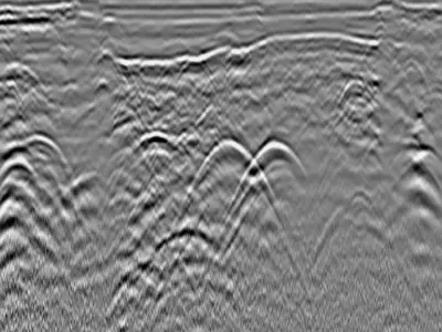
Detection of various buried utilities using a dual-frequency antenna (300 MHz and 800 MHz)
One GPR profile across an avenue, crossing several buried utilities. How many do you see?…
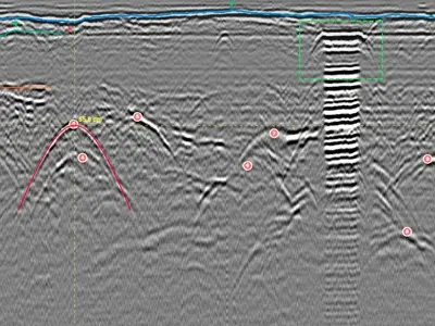
Detection of buried pipes with the NX15 step-frequency ground-penetrating radar antenna
High resolution imaging with the NX15 antenna, for detecting buried cables and pipes. Observe the data quality, ideal for locating small-dia…
GPR for underground utility detection
GPR detects both conductive utilities (metal pipes, cables) and non-conductive utilities (PVC, concrete, clay) via reflections at material interfaces. Its advantage over locators lies in detecting non-metallic pipes and characterizing depth. It complements electromagnetic locators, providing a full picture of the subsurface for damage prevention and mapping campaigns.
Metallic pipe and cable detection
Metal utilities produce strong, easily identifiable hyperbolic signatures on radargrams. Modern GPR software automatically picks these hyperbolas to measure cover depth, spacing, and orientation. This information supports damage prevention protocols and helps map complex utility corridors before infrastructure work.
Non-metallic utility detection
PVC water pipes, concrete drainage lines, and clay conduits produce weaker but still distinctive reflections. Detection depends on the dielectric contrast with surrounding soil — a dry soil around a water-filled PVC pipe gives strong contrast, while saturated soil may attenuate the signal significantly. Multi-frequency surveys often help resolve difficult cases.
Depth and mapping accuracy
GPR depth accuracy is typically ±10% with proper velocity calibration through known-depth targets. Horizontal positioning accuracy reaches centimeter-level precision with cart-mounted systems using odometers or GPS. This makes GPR suitable for documented as-built utility maps required by regulatory frameworks.
GPR frequencies for utility detection
Medium frequencies from 200 to 400 MHz are the most suitable for typical utility depths of 2 to 5 meters. Higher frequencies (600-900 MHz) improve resolution for shallow utilities and dense corridors. Lower frequencies (100 MHz) may be used for very deep infrastructure but sacrifice resolution.
What these datasets let you practise
Interpretation is also knowing what to discard. One dataset shows several buried utilities alongside a pronounced airwave: part of the emitted energy travels through air, reflects off a surface object and returns as a credible-looking hyperbola. Its velocity gives it away — the curve is wider and flatter than a true subsurface reflection at the same apparent depth. Mistaking one for the other puts phantom utilities on a plan.
Other datasets cover the full workflow of a survey campaign: thirty profiles georeferenced with RTK GPS, positioning files included, so detections can be plotted, exported to a GIS and compared with record drawings. A case of utilities absent from the drawings, crossing the line of a planned trench, shows what pre-excavation detection is for. Polyethylene gas service connections and a stepped-frequency acquisition, fine enough for small-diameter services, complete the set.
Which software opens these files · Select these datasets programmatically
Download raw utility GPR data
All datasets are raw .DZT files with no processing overlay. This makes them ideal for utility interpretation training, ML model development for automated utility classification, or software validation. Free download, immediate access, no account creation required.
In preparation
The following datasets are being prepared for this application.
- Locating a buried manhole with ground penetrating radar autumn 2026
- Water main detection and its characteristic radar signature autumn 2026
- Longitudinal tracking of a storm drain with a dual-frequency antenna autumn 2026
- Buried tank detection for safe excavation planning autumn 2026
- HDPE gas service connections detected at 800 MHz autumn 2026
Do you hold an acquisition of this kind? We would be glad to publish it, with credit to the contributor.
Frequently asked questions — Utility GPR
Can GPR find PVC pipes?
Yes, when there is dielectric contrast between the pipe and surrounding soil. Deeper or wet-soil situations may reduce detection performance. Water-filled PVC pipes are typically easier to detect than empty ones.
What is the maximum depth for utility detection?
Depends on soil and frequency. Typical performance: 3-5 m in favorable conditions with a 400 MHz antenna; up to 8-10 m with 200 MHz in dry sandy soil. Wet clay strongly limits depth.
Do these datasets include GPS positions?
When available, .DZG files with GPS traces are included alongside the .DZT radargrams. The dataset metadata specifies whether GPS is present.
Can I use these for autonomous vehicle or robot sensor testing?
Yes. The raw signal data is well-suited for sensor fusion research and autonomous perception development, under CC BY-NC-SA 4.0.
Are the datasets georeferenced?
Some are, with precise coordinates when the contributor permits. Others use generic location tags (e.g., "France") to protect site confidentiality. Metadata indicates the level of georeferencing for each dataset.
Have utility survey data to share?
Every contributed dataset helps improve utility detection training and research worldwide. Contributions from surveyors, utility mappers, and researchers enrich the community.
Submit your data