
Free Geotechnical GPR Datasets
Real-world radargrams for soil characterization, karst detection and buried foundation investigation
Geotechnical engineering relies on accurate subsurface characterization for foundation design, hazard assessment, and construction planning. Ground Penetrating Radar complements traditional methods like boreholes, cone penetration tests, and seismic surveys by providing continuous, non-destructive imaging of the near-surface: soil stratigraphy, water tables, karst cavities, buried structures, and foundation interfaces.
GPRbase provides free geotechnical GPR datasets from real investigation contexts: construction sites, natural terrains, urban foundations, and karst-prone regions. Each dataset contains raw radargrams in GSSI format (.DZT), with acquisition metadata: antenna, frequency, general geology, and target of interest. Data is distributed under Creative Commons BY-NC-SA 4.0, allowing free use for training, academic research, algorithm development, and software validation.
These datasets support geotechnical engineer training, university courses in engineering geology, algorithm development for automated feature detection (karst cavities, boulders, layer boundaries), and case study libraries. The natural variability of the subsurface — soil moisture, layer transitions, buried anthropogenic structures — is captured authentically, providing the complexity that synthetic data cannot replicate.
Geotechnical GPR datasets
Free raw radargrams — download and explore — 6 datasets available
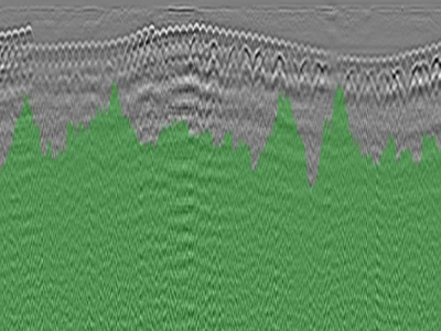
GPR Survey of a Car Park Raft Slab Showing Multiple Defects and Forms of Distress
Profile recorded on the raft slab of a car park showing multiple forms of distress, with a GSSI NX15 antenna at 1.5 GHz. One file. Two phen…
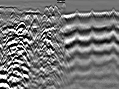
Industrial Slab GPR Survey: Heterogeneous Reinforcement and Subgrade, Inputs for Bearing Capacity Assessment
Profile recorded on a factory floor with a GSSI UtilityScan DF dual-frequency 300/800 MHz antenna, ahead of new works. No records exist, no …
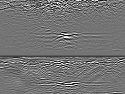
Confirmed Karst Cavities in Limestone — 300 MHz GPR Profiles to 4 m Depth
Raw GPR profiles acquired over limestone containing confirmed karst cavities, using a GSSI UtilityScan DF dual-frequency antenna. The 300 MH…
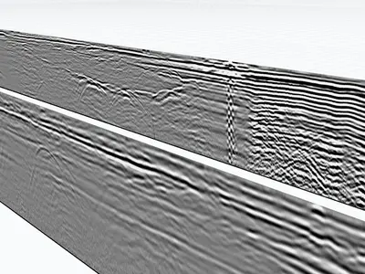
Highway pavement inspection along an emergency stopping lane (ESL)
Six dual-frequency ground-penetrating radar (GPR) profiles (300/800 MHz) showing numerous interfaces and pavement structure layers in a soil…
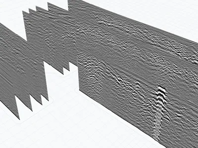
Georeferenced dual-frequency ground-penetrating radar (GPR RTK) files
16 Radar profiles in a parking lot, showing heterogeneous soil conditions. The data is georeferenced and can be imported into GPRviewer for …
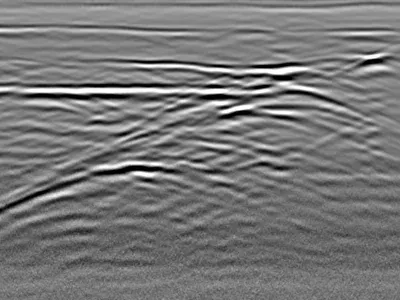
Detection of a backfilled marl pit beneath a road
This profile shows a measurement taken at the level of a roadway, with the presence of a marl pit that has been filled in. Several layers of…
GPR for geotechnical investigations
GPR provides non-destructive, continuous subsurface imaging that complements borehole data and cone penetration tests. It performs best when subsurface features have clear dielectric contrast — sandy soils, dry conditions, and shallow depths give excellent results, while wet clay strongly attenuates the signal. Combined with traditional geotechnical methods, GPR delivers a comprehensive picture of the near-surface for informed design decisions.
Soil characterization and stratigraphy
GPR detects layer boundaries within the soil column: transitions between fill and natural ground, alluvium and bedrock, dry and saturated zones. Continuous stratigraphic profiles support foundation design, settlement prediction, and understanding of site geology. Where boreholes provide point samples, GPR provides the continuous context that links them together into a coherent site model.
Karst and void detection
In limestone regions, dissolution cavities and sinkholes pose serious hazards for construction. GPR detects near-surface karst features by their distinctive signal signatures: strong reflections at cavity boundaries, characteristic diffractions, and signal shadowing beneath voids. Early detection through GPR surveys is critical for hazard assessment, foundation redesign, and safe construction in karst-prone terrain.
Buried foundations and structures
Urban construction sites often overlay old foundations, buried tanks, culverts, or abandoned infrastructure. GPR detects these anthropogenic features before excavation, reducing risk, unexpected costs, and construction delays. In demolition and redevelopment projects, GPR surveys provide the subsurface intelligence needed to plan safely.
GPR frequencies for geotechnics
Frequency selection depends on the investigation depth. 100-200 MHz antennas reach 5-15 m in favorable conditions — ideal for deep karst investigation or aquifer studies. 400 MHz antennas are versatile for shallow soil layer investigation (2-5 m). Lower frequencies penetrate deeper but sacrifice resolution — a fundamental GPR trade-off that must be balanced with your investigation goals.
What these datasets let you practise
Geotechnics carries a particular constraint: ground truth is scarce, and without it an interpretation remains a hypothesis. One dataset escapes that rule, with confirmed karst cavities in limestone. The 300 MHz channel gives usable signal down to 3.5–4 m and images the dissolution voids together with the bedrock interface, while the 800 MHz channel covers the shallow weathered zone. Comparing both frequencies over the same confirmed targets provides an interpretation reference that synthetic data cannot offer.
Other datasets cover a backfilled marl pit under a road, where several earthwork layers stand out against homogeneous surrounding ground, and georeferenced heterogeneous soils suited to both 2D and 3D processing.
Which software opens these files · Select these datasets programmatically
Download raw geotechnical GPR data
All datasets are raw radargrams in .DZT format, without pre-processing or interpretation overlay. This makes them ideal for realistic training in geotechnical GPR interpretation, algorithm development for feature detection, and educational use in engineering geology courses. Free download, immediate access, no account required — just accept the license and receive the files by email.
In preparation
The following datasets are being prepared for this application.
- Extent of a reinforced concrete column footing autumn 2026
- Buried tank detection for safe excavation planning autumn 2026
Do you hold an acquisition of this kind? We would be glad to publish it, with credit to the contributor.
Frequently asked questions — Geotechnical GPR
Can GPR replace boreholes in geotechnical investigations?
No — it complements them. Boreholes provide direct physical sampling and material identification; GPR provides continuous imaging between boreholes. Used together, they give the best overall subsurface understanding.
What depth can GPR reach in typical soils?
Depth depends strongly on soil type and frequency. Typical performance: 5-10 m in dry sandy soils with 200 MHz; 1-3 m in wet clay; up to 15 m in permafrost or dry gravels. Wet clay significantly attenuates the signal.
Can GPR detect the water table?
Sometimes yes, as a distinct reflection horizon where dielectric contrast is strong. Detection depends on soil type and the sharpness of the moisture transition. In practice, the water table shows best in coarse sands and gravels.
Are these datasets from urban or rural contexts?
Both. The dataset metadata specifies the acquisition environment when the contributor permits. Urban datasets often include buried infrastructure interference; rural datasets show natural stratigraphy more clearly.
Can I use these datasets to train karst detection AI?
Yes, under CC BY-NC-SA 4.0. Real karst signatures with natural noise, variable target depths, and authentic soil contexts are especially valuable training data compared to synthetic simulations.
Have geotechnical GPR data to share?
Contributions from geotechnical engineers, researchers, and academics enrich the community. Every dataset submitted helps advance non-destructive subsurface investigation.
Submit your data