
GPR Datasets for Machine Learning and AI
Real-world Ground Penetrating Radar data for deep learning, computer vision and automated interpretation research
Download real-world Ground Penetrating Radar datasets for machine learning, deep learning, computer vision, signal processing and automated GPR interpretation. Every dataset on GPRbase contains raw radargrams recorded on real sites — with the authentic noise, clutter, coupling effects, and target variability that make GPR interpretation a genuinely hard machine learning problem.
Automated GPR interpretation is an active research field: hyperbola detection, rebar localization, utility classification, layer picking, void detection, and end-to-end radargram segmentation. Progress in all these tasks depends on access to real, diverse training data. Synthetic simulators like gprMax are valuable for pre-training and data augmentation, but models trained purely on synthetic data notoriously fail to generalize to field conditions. GPRbase exists to close that gap.
All datasets are free, raw (no processing applied), documented with antenna and frequency metadata, and distributed under Creative Commons BY-NC-SA 4.0 — usable for academic research, including publications, provided derivatives are shared alike. Download the data below, and if your lab produces GPR acquisitions, consider contributing to grow the shared pool.
Datasets for ML research
Raw radargrams with documented acquisition parameters — download and explore — 34 datasets available
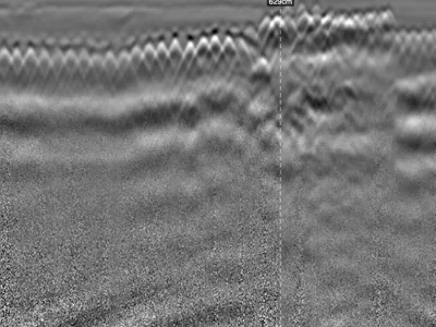
Reinforced Concrete Accessibility Ramp: Three Frequencies, Two 2.5 GHz Antennas and Cross-Polarisation on the Same Profile
Reinforced concrete accessibility ramp surveyed along the same profile with three configurations: dual-frequency UtilityScan DF at 300/800 M…
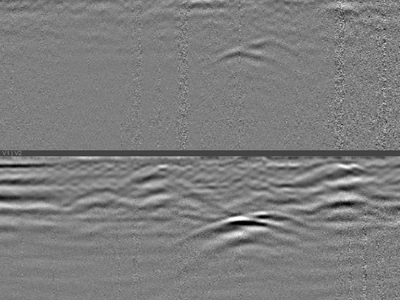
Buried Utilities Beneath a Reinforced Concrete Slab: Detection Through Dense Reinforcement
A 4.50 m profile recorded with a GSSI UtilityScan DF dual-frequency 300/800 MHz antenna, on a reinforced concrete slab, perpendicular to the…
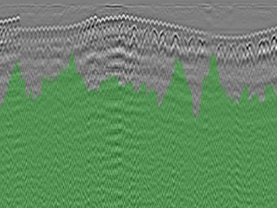
GPR Survey of a Car Park Raft Slab Showing Multiple Defects and Forms of Distress
Profile recorded on the raft slab of a car park showing multiple forms of distress, with a GSSI NX15 antenna at 1.5 GHz. One file. Two phen…
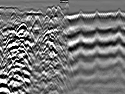
Industrial Slab GPR Survey: Heterogeneous Reinforcement and Subgrade, Inputs for Bearing Capacity Assessment
Profile recorded on a factory floor with a GSSI UtilityScan DF dual-frequency 300/800 MHz antenna, ahead of new works. No records exist, no …
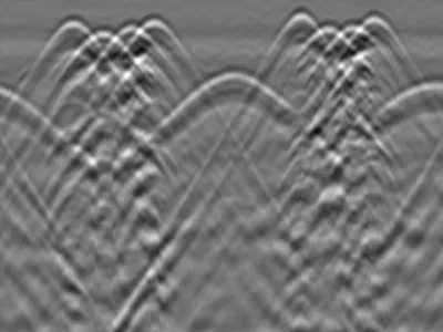
Circular Reinforced Concrete Column : Perimeter Scan and Rebar Repositioning in Section View
Circular reinforced concrete column, 20 cm radius, surveyed by horizontal scanning around its full perimeter with a GSSI FLEX NX dual-channe…
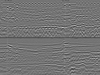
Reinforced Concrete Beam: Continuous Longitudinal GPR Survey with Markers at Two Columns
Reinforced concrete beam, 35 cm thick, surveyed continuously over more than 9 metres with a GSSI FLEX NX antenna. Two user markers were plac…
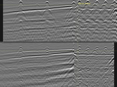
T-Shaped Retaining Wall: Variable Thickness from a Vertical then Horizontal GPR Profile
T-shaped retaining wall surveyed with a GSSI FLEX NX antenna. A single profile, run first vertically up the stem, then horizontally, without…
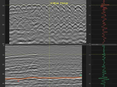
Reinforced Concrete Column — Cross-Polarisation to Image the Far Face and Calibrate Permittivity
Reinforced concrete column surveyed on all four faces, labelled A, B, C and D, by vertical scanning from bottom to top along the centre line…
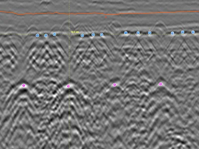
Beam-and-Block Floor — Cross-Polarisation on Inline and Cross-Line Channels
Radargram recorded on a beam-and-block floor with a GSSI FLEX NX stepped-frequency antenna, dual channel: one antenna oriented inline, the o…
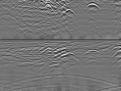
Multiple Utilities and Airwave — Distinguishing Surface Reflections from Buried Targets
Utility survey acquired with a GSSI UtilityScan DF dual-frequency antenna, showing several buried utilities together with a clear airwave si…
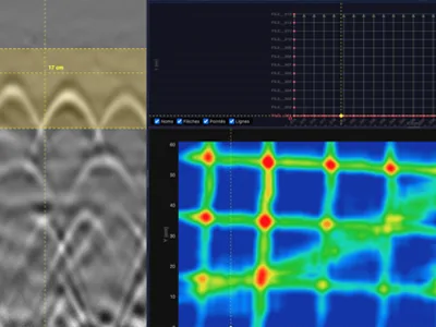
3D Grid on Reinforced Concrete — Rebar Mesh and Diagonal Electrical Cable
3D grid acquired on a reinforced concrete slab with a GSSI StructureScan XT 2.7 GHz antenna: 38 profiles over a 1.2 × 0.6 m area. The horizo…
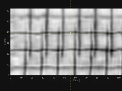
3D Grid on Reinforced Concrete — Welded Mesh Overlap for Rebar Picking
3D grid acquired on a reinforced concrete slab with a GSSI NX25 stepped-frequency antenna, over a 1.2 × 0.6 m area. The slab contains two la…
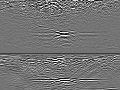
Confirmed Karst Cavities in Limestone — 300 MHz GPR Profiles to 4 m Depth
Raw GPR profiles acquired over limestone containing confirmed karst cavities, using a GSSI UtilityScan DF dual-frequency antenna. The 300 MH…
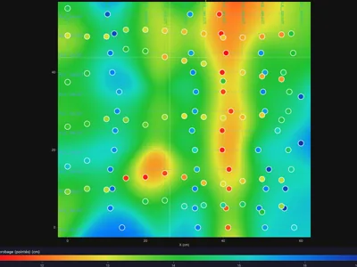
3D Grid on Densely Reinforced Concrete — Rebar Picking and C-Scan Tuning
3D grid acquired on a densely reinforced concrete structure with a GSSI StructureScan XT 2.7 GHz antenna, over a 60 × 60 cm area. The high b…
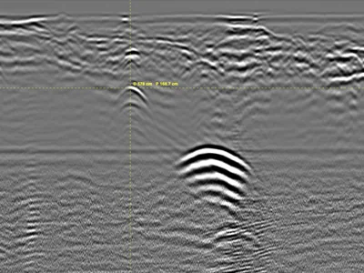
Unrecorded Utility Crossing Under a Street — Parallel GPR Profiles at 350 MHz
Utility survey on a street, acquired with a GSSI UtilityScan 350 MHz HyperStacking antenna: 9 parallel profiles spaced 1 m apart, crossing t…
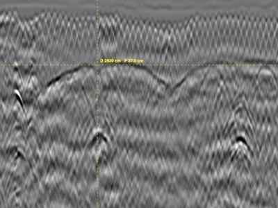
Masonry Vaults in a Historic Monument - Ground penetrating radar - 2 profiles
GPR survey inside a historic monument, acquired with a GSSI UtilityScan DF dual-frequency antenna to locate masonry vaults and characterise …
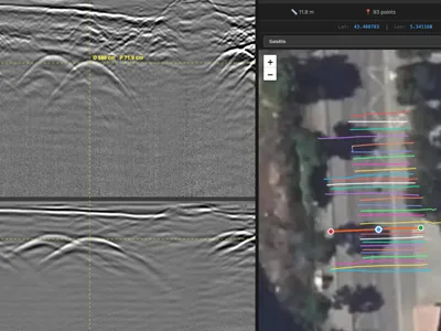
Georeferenced Multi-Utility Mapping - 30 RTK GPR Profiles at 300/800 MHz
Multi-utility GPR survey acquired for cartographic updating ahead of planned works, with a GSSI UtilityScan DF dual-frequency antenna. 30 pr…
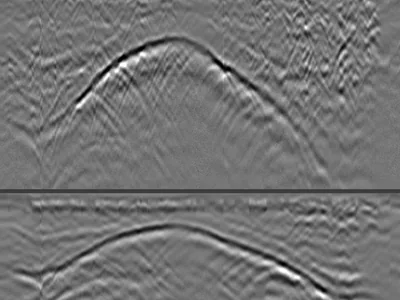
Rib Vault GPR Survey from Above — Backfill Thickness and Structural Geometry
GPR profiles acquired from above a rib vault in a cathedral, with a GSSI UtilityScan DF dual-frequency antenna. Three profiles crossing the …
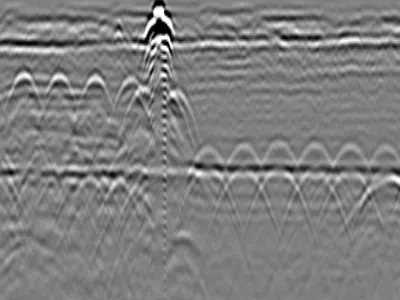
Reinforced Concrete Slab with Expansion Joint
GPR dataset containing 7 files collected on a reinforced concrete slab using a GSSI FLEX NX structure-scanning radar. The data clearly show …
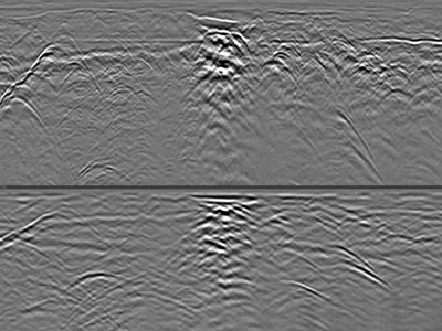
Utilities & Interfaces in Favorable Soil with Deep GPR Penetration
GPR dataset containing 1 file collected with a GSSI UtilityScan DF dual-frequency 300/800 MHz ground penetrating radar in highly favorable s…
Why real data matters for GPR AI
Models trained exclusively on synthetic radargrams learn clean hyperbolas over homogeneous backgrounds — then fail on field data full of surface clutter, antenna ringing, soil heterogeneity, and overlapping reflections. Real datasets expose your model to this complexity from the start. The most robust published approaches combine synthetic pre-training with fine-tuning on real data: GPRbase provides the real component of that recipe.
Machine learning tasks on GPR data
Common research problems include: hyperbola detection and fitting (object localization), rebar detection and cover estimation in concrete, buried utility detection and material classification, layer boundary picking for pavements and stratigraphy, void and defect detection, and full radargram semantic segmentation. Each GPRbase dataset documents its targets, letting you select data matching your task — rebar-rich concrete scans for detection models, multi-utility corridors for classification, layered pavements for boundary picking.
Data structure: from DZT to tensors
A radargram is naturally a 2D array: traces (columns) × time samples (rows), with 16 or 32-bit amplitude values. Python libraries like readgssi load DZT files directly into numpy arrays, ready for PyTorch or TensorFlow pipelines. B-scans can be treated as images for CNN-based approaches, as sequences for recurrent models, or as raw signals for 1D convolutional architectures. The DZT header provides the physical calibration (time range, samples per scan) needed to convert predictions back to depths.
Preprocessing and augmentation
Typical preprocessing includes time-zero correction, background removal (mean trace subtraction), gain compensation, and normalization. Because GPRbase data is completely raw, you control the full pipeline — essential for reproducible research and for studying preprocessing sensitivity. For augmentation, real data can be combined with synthetic radargrams, cropped into patches, flipped horizontally, and noise-injected. Multi-antenna variety across datasets naturally augments frequency diversity.
Generalization across sites and antennas
A model that works on one site with one antenna often fails elsewhere. GPRbase datasets span multiple applications (concrete, utilities, geotechnical, archaeology, roads, geosciences), antennas (from 100 MHz to 2.7 GHz), and site conditions. This variety enables meaningful cross-domain evaluation: train on some datasets, test on held-out sites, and measure true generalization rather than site memorization.
Which datasets for which task
Not every dataset suits the same work. For hyperbola detection and fitting, reinforced concrete acquisitions offer numerous, regular targets of known geometry — and a welded mesh overlap zone provides the hard case, where responses overlap to the point of defeating automatic detection.
For segmentation and interface tracking, pavement profiles and surveys in favourable ground show continuous, legible layers. For void detection, one dataset covers karst cavities confirmed on site: it is the only one in the catalogue carrying that guarantee, and it is worth more than a larger unvalidated set.
For handling false positives, one profile combines buried utilities with an airwave — two neighbouring signatures, one of which corresponds to no buried target at all. Finally, the 3D grids, documented in spacing and origin, suit volumetric approaches, and georeferenced surveys suit work coupling detection with coordinates.
What these datasets are not
Better said plainly than left to be discovered: these datasets are not evaluation benchmarks. They are not annotated, carry no masks or bounding boxes, and ground truth exists for only some of them. Publishing them as a benchmark would be misleading.
They are documented field acquisitions, useful for experimentation, pre-training, robustness testing and qualitative validation. Acquisition parameters vary from one campaign to the next, because these files come from real jobs rather than from a protocol designed for research — which is both their limitation and their point. Annotation and verified ground truth are on the roadmap.
Citing and publishing with GPRbase data
CC BY-NC-SA 4.0 permits research use including peer-reviewed publications, with attribution. Cite the dataset identifier (dsXXX) and the GPRbase URL in your data availability statement. If you build annotated versions (bounding boxes, masks, picks), the share-alike clause means publishing them under the same license — growing the commons for the whole GPR ML community.
Accessing metadata programmatically
The catalogue is exposed as JSON, freely and without a key: /api/datasets.json returns every dataset with its application, antenna, frequency and targets. A Python and JavaScript client, published under the MIT licence with no dependencies, filters the catalogue, exports it to CSV and generates citations. It is available on GitHub and has its own DOI.
Frequently asked questions — GPR machine learning
Are these datasets annotated?
The datasets are raw radargrams with documented targets in the metadata, but without pixel-level annotations. Target descriptions (rebar, utilities, layers) guide your own labeling. Annotated derivatives shared under CC BY-NC-SA 4.0 are welcome contributions.
How do I load DZT files in Python?
The readgssi library reads DZT files into numpy arrays: pip install readgssi, then readgssi.readgssi(infile=path). GPRPy is an alternative with processing functions. From numpy, the data goes directly into PyTorch or TensorFlow.
Can I use these datasets in a published paper?
Yes, CC BY-NC-SA 4.0 permits academic publication with attribution. Cite the dataset identifier and GPRbase URL. Non-commercial use only; commercial licensing requires contacting info@gprbase.com.
Is the data enough to train a deep network from scratch?
For most deep architectures, combine it with synthetic pre-training (e.g., gprMax simulations) or self-supervised learning, then fine-tune on the real data. Patch-based training multiplies the effective sample count significantly.
Do the datasets share a common format?
Yes — all datasets are GSSI DZT files with consistent structure, which simplifies building a single data loader across the whole collection. Antenna and frequency metadata allow conditioning or filtering.
Working on GPR + AI? Contribute your data
Every contributed dataset grows the shared training pool for the entire research community. Raw acquisitions, annotated sets, and benchmark splits are all welcome.
Submit your data